Walking
Find walking routes in the Borough
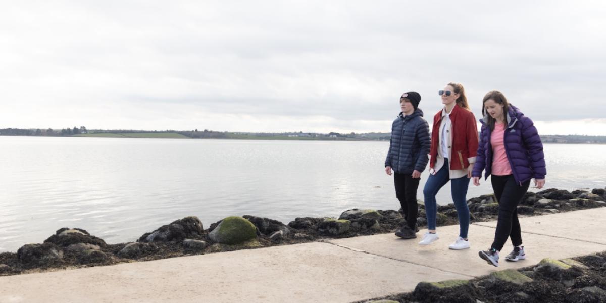
Find walking routes in the Borough
Bangor Cycling and Walking Heritage Trail Map
A grassland walk situated at the very tip of the Ards Peninsula at the mouth of Strangford Lough. This walk passes through farmland, rocky shore and beach owned and managed by the National Trust and National Nature Reserve owned and managed by the Environment and Heritage Service.
Castle Espie, situated on the shores of Strangford Lough near Comber, County Down, is the newest WWT visitor centre and the Trust’s first in Ireland.
The centre’s buildings are a visitor attraction in their own right because of their history and the numerous eco-friendly features they incorporate, including reclaimed and recycled materials, a wildlife garden and energy systems fuelled by the sun and wind.
Castle Espie’s main draw, though, is its magical mix of wide estuary views, tidal lagoon, eel-grass mats, woodland walks, salt marshes and reed beds; the presence of Ireland’s largest collection of native and exotic water-birds
Accessible at low-tide, this walk around Rough Island provides magnificent views of Strangford Lough and is an excellent view point for bird watching.
The wood offers a choice of 3 walks from the car park through the mixed woodland. A popular site for local dog walkers.
Steady climb on woodland paths to viewpoint before descent through woodland to finish. Enjoy the peaceful surroundings of this former estate woodland which is the result of planting in the mid nineteenth century. Viewpoint over Killynether and drumlin countryside beyond.
The walk takes in the summit of Scrabo Hill and the famous Scrabo Tower built in 1857, one of Ireland's best known landmarks. The views over Strangford Lough and North Down are some of the finest in the country. The walk then descends to the disused sandstone quarries which provided building stone since Anglo-Norman times. The old quarries have major geological importance and have been designated an Area of Special Scientific Interest.
A pathway along the lake allows for closer inspection of the birds. For example, swans, mallards, little grebe, moorhens, and coots are usually present. There is an observation area to view the birds and other wildlife. Parking is available. In July 2000, Kiltonga Nature Reserve became the first site in the UK to be awarded BT Millennium Miles status.
Linear walking route across the northern strand of Strangford Lough. The route crosses the sea defenses that protect reclaimed lands to the south of Newtownards.
The famous gardens at Mount Stewart were planted in the 1920s by Edith, Lady Londonderry and have been nominated a World Heritage Site. Visitors can walk through magnificent woodlands, viewing the flora and lake, beautiful throughout the entire year.
Welcome to the Red Trail on the Mount Stewart estate. Mount Stewart gardens were acquired by National Trust in 1957, with the house following in 1977; the wider estate was acquired in 2014, bringing the total area to just under 1000 acres. The first areas that have been opened to visitors incorporates the Red, Blue, and Yellow Trails. The Red trail is the main circular walk, and loops through a mixture of woodland and farmland. There are a number of points of interest along the walk, including working farmland, the ruins of a folly, and water features. Red squirrels may be seen in the trees, or running along the ground to get into a tree. The best times to walk the red trail are early in the morning or late afternoon, especially in Autumn.
The new wood was formerly an area of grazing fields set upon a drumlin in the rolling hills landscape typical of the Ards Peninsula, with gentle slopes down to the nearby lough and farmland. From the top of the wood you can see down to Strangford Lough and across the Portaferry House lands.
Once part of the Nugent's Estate and now managed by The National Trust, this gentle walk is through a mature wood of mixed broad leaved trees. Visitors will enjoy spectacular views across the Strangford Narrows, towards Audleys Castle and Castleward. Nugent's Wood is home to Red Squirrels, badgers and has an impressive display of spring flowers such as bluebells, stitchwort and honey suckle.
The beauty of the rugged coastline, simple character of the dwellings and unspoilt, timeless character of the village makes Kearney truly special.
A short community trail facilitating access to Slans Graveyard with incredible panoramic views overlooking Cloughey.
This walking tour takes in the historic sites and locations dotted around Ballywalter, Ballywalter Beach and other sites located on the Irish Sea coast of the Ards Peninsula. Ballywalter is an old fishing village with a harbour dating back to the mid 1800's.
The Rocky outcrops of Orlock Point contain a mosaic of semi-natural habitats which support a rich diversity of plants and animals. The walk affords stunning views of the Copeland Islands and out across the Irish Sea towards Scotland. The area is steeped in archaeology and history, with evidence of Vikings, smugglers and World War II defences.
Link Section linking Quality Section - North Down Coastal Path to Quality Section – Lecale Way; following the eastern coast along the Ards Peninsula before cutting across to Portaferry on the shores of Strangford Lough. There is a regular ferry service between Portaferry and Strangford.
The route mainly follows the busy A2 coast road with intermittent sections on quite rural roads and coastal paths. There are some opportunities to walk along beaches.
There are transport links between these Quality Sections.
This rocky outcrop along the shores of Belfast Lough, on the west side of Groomsport is covered in gorse and shrubs, good for rough walking, and for spotting birds, flowers and foxes.
Ballymacormick is just on the edge of Belfast Lough, so there are interesting views north and west.
A gentle walk taking in the Wildflower Meadow, areas of mature woodland, and a coastal stretch. The Wildflower Meadow and 21 acres are a blaze with colour in the summer months when the orchids and wildflowers are in bloom.
The Clandeboye Way is a great off road walk through a variety of landscapes with lots to see along the way. Of historical interest is Helen’s Tower and the old Leadmines at Whitespots Country Park. The path leads through old laneways, some farm tracks and woodland paths.
Please note – this walk involves crossing the main Bangor to Belfast dual carriageway.
North Down Coastal Path extends from Holywood in the west to Orlock in the east. The path passes through coastline and parkland. Historic relics and flora and fauna are found in abundance, including the grey seals which can be spotted offshore.
Please be aware that sections of the North Down Coastal Path follow private roads. Please respect the Highway Code when walking, cycling or running along these sections where residential traffic will have right of way. Northern Ireland has very few public rights of way and therefore in many areas walkers can only enjoy countryside walks because of the goodwill and tolerance of local landowners. In the interests of your own safety please be respectful when using the area for recreational purposes.
A variety of walks are available in Redburn. All walks start from the main car park. Those who do venture to the top are rewarded with amazing views over Belfast Lough.
North Down Coastal Path extends from Holywood in the west to Orlock in the east. The path passes through coastline and parkland. Historic relics and flora and fauna are found in abundance, including the grey seals which can be spotted offshore.
In partnership with 
While we want you to enjoy your outdoor experience, we would request that you do so responsibly by following these simple steps: